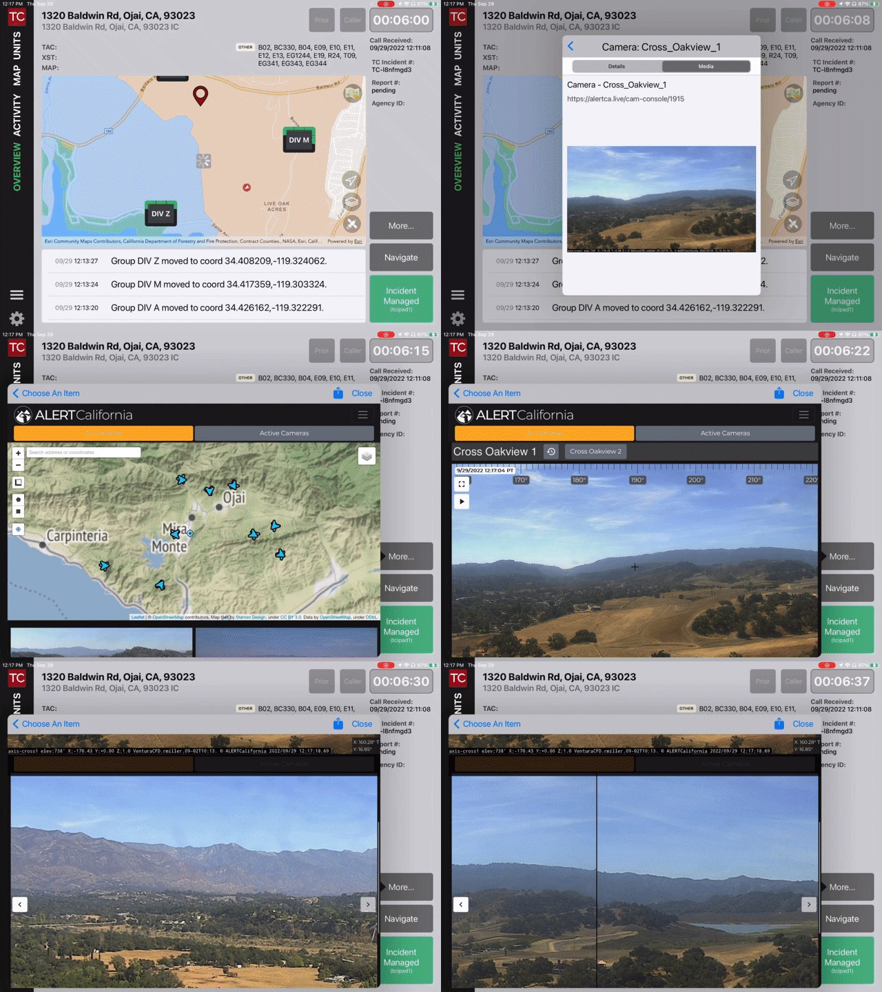
Late last week most of the AlertWildfire Cameras were no longer available from the AlertWildfire Web site and therefore from the authoritative CalOES California Webcams map layer, which many of Tablet Command customers use routinely to access live camera feeds. Many of the camera feeds are now available on the Alert California site, but there is not a map layer available to replace the CalOES layer. Several customers reached out with concerns about not having access to this important situational awareness tool at a critical time during the California Wildland season.
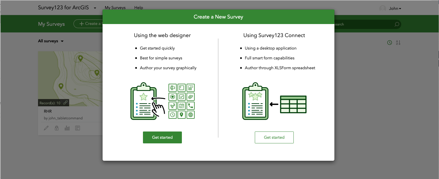
Agencies can combine the power of Tablet Command, ESRI’s Survey 123 and ArcGIS Online to quickly collect and display geospatial data. These powerful collaborative tools can be used for a wide variety of situations including damage assessments, marking hazardous occupancies, and identifying safe zones and lookouts during wildland pre-incident planning.
Topics: maps, TabletCommand, GIS
The 2019 wildland season is upon us, and whether you are a firefighter or a chief officer, the mapping features in Tablet Command (iPad) and TC Mobile (iOS/Android) can enhance your situational awareness, safety, and effectiveness while responding to wildland fires.
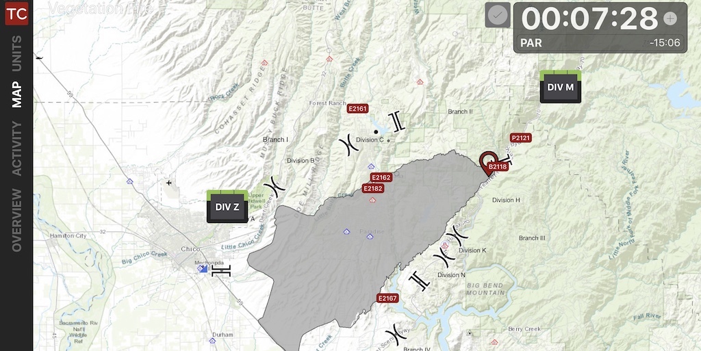
As crews are dispatched, they can immediately view an incident in Tablet Command with a variety of base maps and map layers in the “Overview” screen or by tapping the “Map” tab within an incident on their iPad or Smartphone. In these views responders can see the fire ground from an overhead perspective, providing head start on “LCES” (Lookouts, Communications, Escape Routes, Safety Zones) and insight into situational and resource status.
Topics: Accountability, maps, wildland, incident response, GIS, USNG
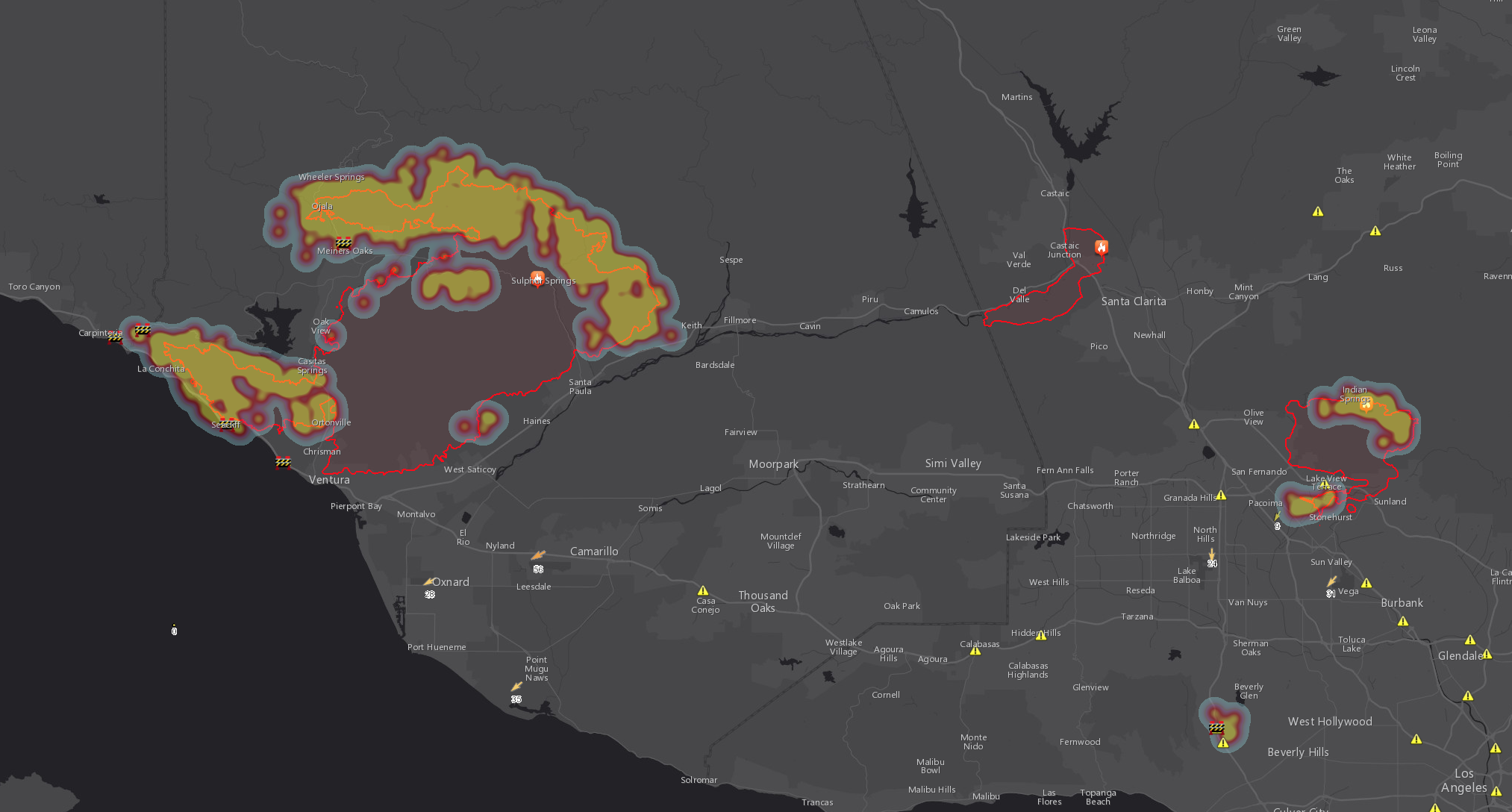
Since Sunday, the Tablet Command team has been watching for updates and had a difficult time locating maps that displayed the hotspots of the fire and active fire perimeters. We found that the information on other maps was not complete or useful. We decided to make our own with one of the great tools that we use frequently.
Esri provides some excellent tools and one of those tools, ArcGIS Online is used by Tablet Command to support our customers access to agency GIS information. ArcGIS Online is a great way for any agency to create custom web maps with dynamic data within a matter of minutes. We created this web map with Esri ArcGIS Online in about 20 minutes. We have been using it so much that we decided that we should share it with everyone.
Topics: Esri, Fire, Fire Command, incident command, incident management software, maps, Tablet Command
Sometimes a picture is worth much more than a thousand words. Especially when those words are taking up valuable radio bandwidth.
Topics: Accountability, AVL, Blog, ICS, map, maps, situational awareness


