Since Sunday, the Tablet Command team has been watching for updates and had a difficult time locating maps that displayed the hotspots of the fire and active fire perimeters. We found that the information on other maps was not complete or useful. We decided to make our own with one of the great tools that we use frequently.
Esri provides some excellent tools and one of those tools, ArcGIS Online is used by Tablet Command to support our customers access to agency GIS information. ArcGIS Online is a great way for any agency to create custom web maps with dynamic data within a matter of minutes. We created this web map with Esri ArcGIS Online in about 20 minutes. We have been using it so much that we decided that we should share it with everyone.
California Wildfires Map - http://arcg.is/15Kaer
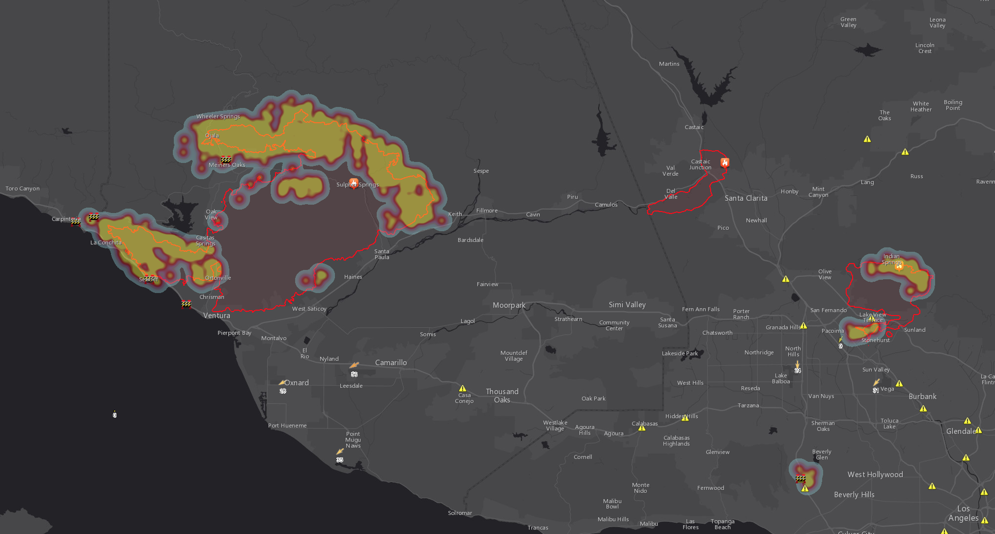
The map features MODIS infrared satellite active fire mapping data from NASA, California Highway Patrol incidents and road closures, NOAA current weather observations, and CalFire Fire Perimeters. All data is updated on a 10 or 15 minute interval from publicly available data.
We also want to take this opportunity to acknowledge those that have been impacted by the fires. As firefighters we understand the challenges and difficulty these events have created both personally and professionally. We wish those on the fire lines, including Tablet Command Co-Founder Andy Bozzo, safety and endurance in this time of chaos.
Read more about:
